Herring 15

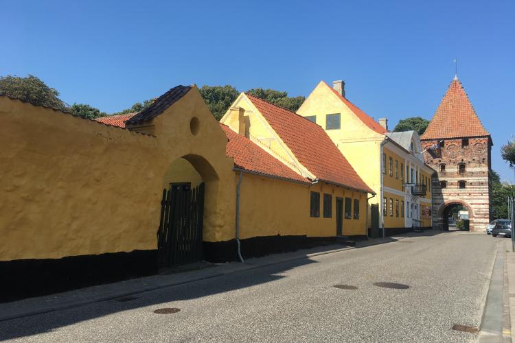
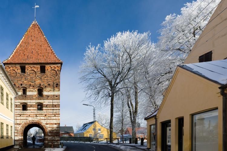
Now you are standing exactly where Stege in the 1100s originated as a small fishing village on the king's grounds around a boatyard at the deep bridge. The fishing village gradually grew east towards Dybsbrostræde, which is Stege’s oldest street. Formerly, the street ended with a bridge and an entrenchment as depicted in both Dahlberg and Resens old maps and on the information sign at the harbour.

Herring 14

Now follow Nørresti, which is not marked on old maps, as this was where the shoreline went back in the Middle Ages. You will also notice that the houses on the right side are of significantly newer date. On your left side you will see those characteristic long, narrow plots which are typical for Stege. You built on a plot as narrow as possible to save tax, as you had to pay taxes in proportion to how many doors and windows the property displayed towards the street. The long area west of Langgade (and south of Storegade) also provided for a boat bridge at the shore.

Herring 13

Continue left from the path of the ramparts on to Langelinie. Pass the Private Hospital and the Health Centre (the old hospital). Now, you approach the old, original part of Stege, which was given municipal charter by Erik Klipping in 1268. At the hospital premises - with the gable towards the old Langestræde - Sct. Eriks Guild House was built back in the Middle Ages. This, in memoriam of Erik Plovpenning, who had been murdered at Slien in 1250.

Herring 11

Above the door, you will notice a nice plaque with Frederik IV’s monogram and the year 1703. In 1697, after the deroute of the Møn population, Frederik IV donated 4000 rix-dollars for the construction of a nautical school. In 1703 the construction began, and in 1705 the school was ready for occupation. Unfortunately, there were problems with recruiting students for the school, meaning that only 6 officers were trained during the next 22 years! The school closed down and the building was turned into a prison and draper’s house. Later, it became a nursing home for the mentally ill.

Herring 10

Now, cross Rådhusgade and continue on that part of the ramparts where the home ‘Birkely’ is located on the left. The name ‘Hage’ belongs to one of Steges most important families. It can be traced back to the 17th century and has in many ways influenced the town. As such, the home ‘Birkely’ was built in 1871 by A. and V. Hage as an orphanage. In 1924 it was taken over by Stege municipality and served as a nursing home. In 2001 it was renamed ‘Oasen’ (i.e the Oasis’) and is currently functioning as a place for the mentally ill.

Herring 9

Møllebrøndsstræde was formerly named Nørrestræde. It stretches today exactly as in the 17th century, where this stretch and the embankment encircled the town’s hop garden. The garden provided the town's breweries with hops for beer brewing.

Herring 8

The low half-timbered house situated at Storegade is the only preserved part of the original merchant house from the 1770s. The Empire house - the current main building just after the town gate - was built in 1813 in a classical style (French Empire style) with Dutch doors and English windows, together with warehouses, a shop and even a public bar. Since 1958, Møns Museum has been housed in this beautiful old property.

Herring 7

In the Middle Ages, Denmark was bristling with fortifications, several of them with moats, ramparts or walls with town gates. But only in one place has such a medieval fortification system been preserved: right here, in Stege, with its wide, beautiful and well-preserved ramparts and the town gate – Mølleporten. Stege’s town gate is one of Denmark's two preserved medieval town gates.

Herring 6

Back when the castle was still standing, the garden that stretches from Søndersti to the large white house functioned as its apple orchard. The white house was for many years a judicial office, and now houses a local insurance company.

Stege formerly had two churches. Saint Gertrud's church was built east of the town, which was really quite small then, in the place where the parking lot is now located (on the other side of the former judicial office). Hence, the street after the parking lot which leads to Gåsetorvet, is called Saint Gertrud Street.

Herring 5

Sct. Knudsstræde, whose name arise from Saint Knud, who was a saint for all trade, leads directly to the town's shopping street. During excavations in 1968, a seal of Saint Knud was found, and in 1973 it was decided to change the name from Smith Street to Saint Knuds Street. Smith Street had originally been given its name because of a smithy on the eastern side of the street which had operated there since 1845. In former times, the street had been named Baker Street. Back then, the bakers had been sequestered to live here at the southern border of the city ...